NORTH YORKSHIRE WALKS - Robin Hood's Bay and Fylingdale
Fylingthorpe - Raw - Robin Hoods Bay - Fylingthorpe - Fylingdale -Ravenscar - Robin Hood's Bay - Fylingthorpe.
13 miles - footpaths, fields, tracks and lanes with a bit of beach if the tide's out.
(ALL PHOTOS IN THIS NOTE ARE BY THE OLD MAN OF THE NORTH AND ARE COPYRIGHT)
Fylingthorpe - Raw - Robin Hoods Bay - Fylingthorpe - Fylingdale -Ravenscar - Robin Hood's Bay - Fylingthorpe.
13 miles - footpaths, fields, tracks and lanes with a bit of beach if the tide's out.
(ALL PHOTOS IN THIS NOTE ARE BY THE OLD MAN OF THE NORTH AND ARE COPYRIGHT)
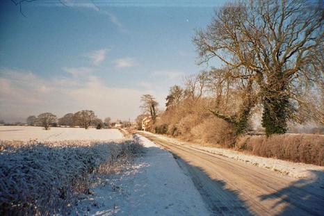
This is a figure-of-eight walk starting and finishing in Fylingthorpe, that lovely village just above Robin Hood's Bay on the North Yorkshire coast. The route takes you through Fylingthorpe to the hamlet of Raw and into the newer parts of Robin Hood's Bay using the backways, paths and lanes that are the best way of experiencing this beautiful and secluded corner of the county.
From Bay the way takes you back into Fylingthorpe and through the fields to Fyling Hall again making use of the backways. From here you ascend gently into the woods by Ramsdale Mill and Carr Wood before dropping back through the fields to the delightful Fyling Old Hall. Here the route changes from the backways to the easy but beautiful track of the old railway taking you almost to Ravenscar. Here a diversion to the old Alum Works provides a compliment to the industrial history of the railway.
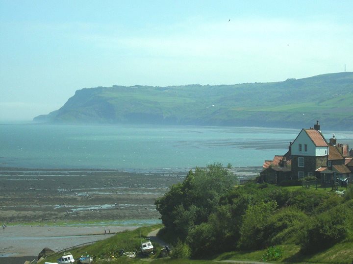
Then it's back to quiet rural ways with a section of the Cleveland Way long distance footpath taking you along the cliff tops to Stoupe Bank where, if the tide is out, you can take to the beach for a relaxing stroll along the sands back to Robin Hood's Bay. At Bay you enter the old town and it's worth taking a little time to explore the numerous and absorbing alleyways before heading back towards the landing slip and off to the right through little woods to Fylingthorpe and the end of the walk.
Park somewhere in Fylingthorpe village, the parking in Robin Hood's Bay (Bay) is usually taken up and time restrictions apply. Take care not to block any of the village roads or drives. I found suitable parking on Middlewood Lane with its memories of family visits to grandparents, (in fact I walked close by three of their former homes).
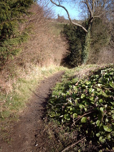
Head back into the village to Thorpe Green and look for a lane with a footpath on it between the houses, known locally as Dark Lane. This path takes you on the first of the backways which give such an immersion into the real character of the area.
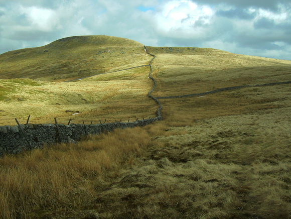
I find the open grouse-moors of the North York Moors desolate and uninviting, with all their intensive management. They are not places for me and the beauty of a few weeks of blooming heather cannot erase the knowledge of the mono-cultural habitat and persecution of wildlife that goes with the management of these moors. In contrast the gentle land management of the farming land that makes up that natural amphitheatre of Fylingdale with it's relatively happy co-existence of nature with farming is most appealing. Of course these are the lands of my forebears and I feel at home in them, they are familiar but there is an undeniable gentleness to the place that should appeal to you too.
From Bay the way takes you back into Fylingthorpe and through the fields to Fyling Hall again making use of the backways. From here you ascend gently into the woods by Ramsdale Mill and Carr Wood before dropping back through the fields to the delightful Fyling Old Hall. Here the route changes from the backways to the easy but beautiful track of the old railway taking you almost to Ravenscar. Here a diversion to the old Alum Works provides a compliment to the industrial history of the railway.
Then it's back to quiet rural ways with a section of the Cleveland Way long distance footpath taking you along the cliff tops to Stoupe Bank where, if the tide is out, you can take to the beach for a relaxing stroll along the sands back to Robin Hood's Bay. At Bay you enter the old town and it's worth taking a little time to explore the numerous and absorbing alleyways before heading back towards the landing slip and off to the right through little woods to Fylingthorpe and the end of the walk.
Park somewhere in Fylingthorpe village, the parking in Robin Hood's Bay (Bay) is usually taken up and time restrictions apply. Take care not to block any of the village roads or drives. I found suitable parking on Middlewood Lane with its memories of family visits to grandparents, (in fact I walked close by three of their former homes).
Head back into the village to Thorpe Green and look for a lane with a footpath on it between the houses, known locally as Dark Lane. This path takes you on the first of the backways which give such an immersion into the real character of the area.
I find the open grouse-moors of the North York Moors desolate and uninviting, with all their intensive management. They are not places for me and the beauty of a few weeks of blooming heather cannot erase the knowledge of the mono-cultural habitat and persecution of wildlife that goes with the management of these moors. In contrast the gentle land management of the farming land that makes up that natural amphitheatre of Fylingdale with it's relatively happy co-existence of nature with farming is most appealing. Of course these are the lands of my forebears and I feel at home in them, they are familiar but there is an undeniable gentleness to the place that should appeal to you too.
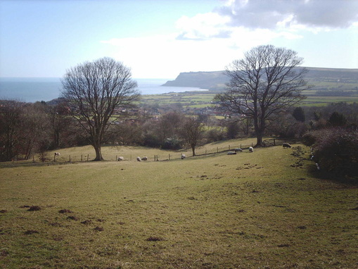
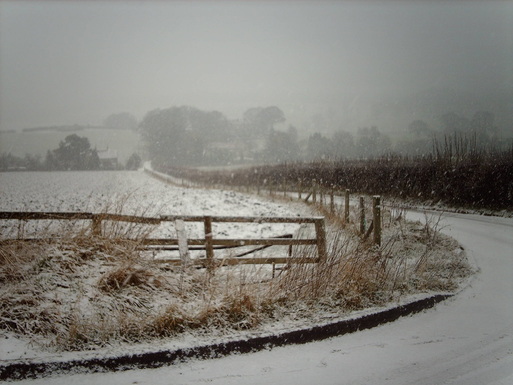
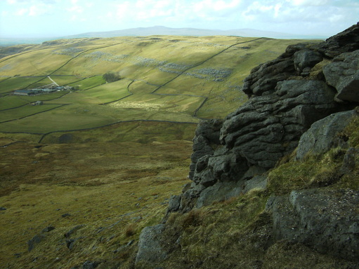
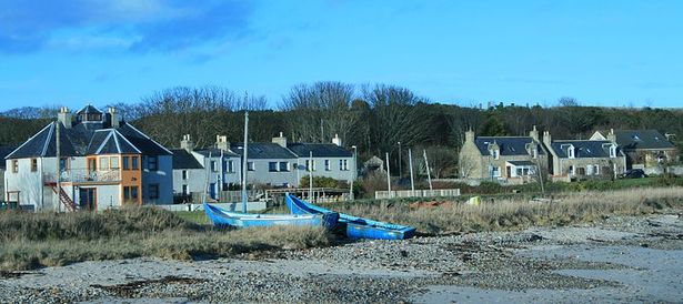
Dark Lane will take you up to the farming hamlet of Raw, on the hillside above Fylingthorpe. The first family holidays I can remember were spent here in a very old house with an outside loo. To a little kid it was magical, a seemingly forgotten corner of the country. On reaching the road turn left and cross the ford, following the lane uphill into Raw. Here a footpath on your right takes you through a farmyard and across the fields onto Raw Lane towards a church. The views from around Raw across Robin Hood's Bay to Ravenscar are spectacular and well-worth pausing for (and to catch your breathe after the walk up the lane).
At the church cross straight over the B-road onto High Lane and head for Smailes Moor farm. At the farm turn right onto Smailes Lane, another lovely backway, into Robin Hood's Bay's new town. The end of the lane takes you out onto the main road (B-road). Follow it downhill into the crook of the bend. Take the road into the car-park and past alongside the old station. This lane drops you back onto Thorpe Lane at the edge of Fylingthorpe. Cross the road and continue on the old railway line through the fields to Middlewood farm. Here take the footpath onto Middlewood Lane and turn right, cross the road and take the footpath behind the houses. This drops you onto the top of Middlewood Crescent before pointing you uphill again towards Park Gate and Fylinghall.
At the church cross straight over the B-road onto High Lane and head for Smailes Moor farm. At the farm turn right onto Smailes Lane, another lovely backway, into Robin Hood's Bay's new town. The end of the lane takes you out onto the main road (B-road). Follow it downhill into the crook of the bend. Take the road into the car-park and past alongside the old station. This lane drops you back onto Thorpe Lane at the edge of Fylingthorpe. Cross the road and continue on the old railway line through the fields to Middlewood farm. Here take the footpath onto Middlewood Lane and turn right, cross the road and take the footpath behind the houses. This drops you onto the top of Middlewood Crescent before pointing you uphill again towards Park Gate and Fylinghall.
From Park Gate a little flagged pathway takes you past the front doors of cottages and onto the road beside Fyling Hall school. The little flagged path, as much as anywhere on this walk, captures the feel, the essence, of this area. Cross over the road and take the marked right of way up the track towards Ramsdale Mill.
There are two entrances running off the public road, side by side, take the first, the upper way. The other leads only to a building of the school. This lane, running through High Park Wood has, of course, the feel of an old estate road, but with the Hall now a school any lingering unease at wandering through the posh guys land can be dismissed. Enjoy the woods and the birds.
There are two entrances running off the public road, side by side, take the first, the upper way. The other leads only to a building of the school. This lane, running through High Park Wood has, of course, the feel of an old estate road, but with the Hall now a school any lingering unease at wandering through the posh guys land can be dismissed. Enjoy the woods and the birds.
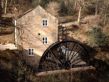
After briefly emerging into the open this lane again plunges into the woods,past a waterfall and down to the hairpin at Ramsdale Mill with its impressive wheel intact. The woods here are oak woods and are full of wildlife.
You're now about 5 miles into your walk and will be more than ready for your first longer break, perhaps a coffee too. Fyling Old Hall, some mile and a half further on) used to do very nice teas in the garden but you might as well take advantage of the beautiful countryside and have a break hereabouts too. I struggled on a little further past the woods but you might enjoy the oakwood scenery.
From the mill follow the lane through Carr Wood and below the intriguing Chapel Garth, a small, isolated patch of public access land. Whether there was indeed a chapel here or whether the garth was simply a small field granted to a chapel, I do not know.
At the edge of Carr Wood follow the farm track to your left, downhill, through the fields towards Swallow Head Farm. Here, just above the farm, among the gorse, is where I finally made my pause and enjoyed coffee and sandwiches overlooking the farm, fields and the sea beyond.

This track is sometimes more than a little muddy from the passing of the cattle but you'll manage to pick your way around the hoof-holes and make your way past the farm to the roadside below. Turn right here towards the lovely Fyling Old Hall.
When I was a child we'd often come by the Old Hall and it always had a feel of gloom about it, almost a haunted-house atmosphere, but now it's looked-after and cared for and pleasant again. The present hall is old but there was an older building or buildings here for Fyling Hall (and not the present Hall up the hill) was mentioned in the Domesday Book. If the Old Hall still does teas in the garden it's a nice spot to stop, otherwise carry on along the road before taking the disused railway track to your right.
When I was a child we'd often come by the Old Hall and it always had a feel of gloom about it, almost a haunted-house atmosphere, but now it's looked-after and cared for and pleasant again. The present hall is old but there was an older building or buildings here for Fyling Hall (and not the present Hall up the hill) was mentioned in the Domesday Book. If the Old Hall still does teas in the garden it's a nice spot to stop, otherwise carry on along the road before taking the disused railway track to your right.
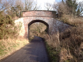
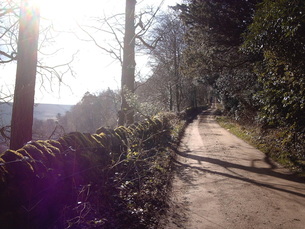
Now your walk makes a change. Gone for now are the little, almost secret backways and instead you tread in the tracks of our industrial history. Not today's urban industry but the industry of old where works of all sorts sprang up in the countryside. In years gone this vital industries brought work to rural communities but at some cost to the peace of the countryside, not to mention the scars left behind. Today those scars are largely grown over and add to rather than detract from the rural scene. This railway is an example of this. The old bridges, cuttings and embankments show the work that went on and into the railway, and the ghost of the railway station at Fyling Old Hall tells of former use. Yet the trees and bushes, glimpses into the fields and the wildlife make this a beautiful section of the walk and the almost flat nature of the railway bed makes for easy going too.
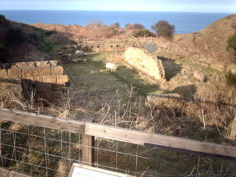
Follow the railway line around the foot of Stoupe Brow and enjoy the seaward views. Past Susanna Hill and Stoupe Brow farm you'll encounter another relic of industrial times with the great alum quarries cut into the hillside above you and below. Here the Cleveland Way turns off the railway bed and plunges through the trees and bushes downhill to your left. Follow this and look out for the permissive footpath running off to your right to the old Alum Works.
Here, alongside many others, an ancestor of mine worked amidst the toil, sweat and clangour of industry amidst the fields cliffs below Ravenscar. Take the time to detour into the old works, there is much in the way of ruins to be seen and the interpretation boards do a good job alongside imagination of bringing the place to life.
This is also a favourite spot for adders, our only poisonous snake, so take care and leave the snakes alone if you see them. Don't bother them, they won't bother you.
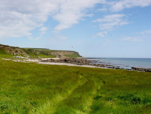
Back to the Cleveland Way continue north-west to the cliff-tops and follow the Way to the lane south of Stoupe Bank. Continue along the lane by the farm.
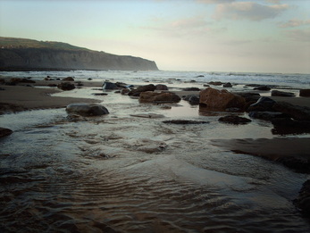
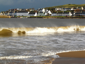
If the tide is in you'll need to drop down into the hollow below the farm and back up the other side, continuing along the Cleveland Way into Robin Hood's Bay, crossing Boggle Hole en route. But, if the tide is out,take the steps down into the hollow of Stoupe Beck and head onto the beach. Keeping an eye on the tide enjoy a leisurely stroll along the lovely shoreline towards Robin Hood's Bay.
By Stoupe Beck would be a great place for a final break, with sea-views and the sound the coast in your ears.
At
Robin Hood's Bay you could simply ascend the slipway and take the
little lane on your left up by Marnar Dale beck below Cowfield Hill but
then you'd miss the opportunity to explore a truly unique village.
There are a few pubs in the village as well as cafes that could offer
you refreshment but the real treasures in the one-time smuggling haunt
are the numerous twisting, turning,half-hidden alleys and snickets that
criss-cross the village. Take a wander through these before heading
back down to the lane to Marnar Dale above the slipway.
Finally head into Marnar Dale and through the tiny woodland before emerging into fields. Follow the track up the old railway once again and follow it to your right briefly before taking a footpath on your left back into Fylingthorpe and the end of the walk.
Finally head into Marnar Dale and through the tiny woodland before emerging into fields. Follow the track up the old railway once again and follow it to your right briefly before taking a footpath on your left back into Fylingthorpe and the end of the walk.
NORTH YORKSHIRE WALKS - Howardian Hills
Scackleton to Fryton Moor via Hovingham - 12 miles
(ALL PHOTOS ARE BY THE OLD MAN OF THE NORTH AND ARE COPYRIGHT)
Starting from the farming hamlet of Scackleton, just off the road from
Terrington to Hovingham, you can find roadside parking near the little
church. Walk on through the hamlet to the upper end and keep straight on where two roads meets the 'village' street.
This lane continues downhill through farmland to a delightful little hollow by an old and restored mill on a bend. The little beck here is home to trout. Continue on up the other side of the hollow on the lane until you reach the edge of the neighboring hamlet of Coulton. Here a footpath bears off to your right and heads back a little across a field before joining a farm track through the fields. From the crown of the fields the footpath heads down again towards the trees and some fishing ponds. Watch out for wildlife all along this walk, and especially here where field, water and woodland meets.
This lane continues downhill through farmland to a delightful little hollow by an old and restored mill on a bend. The little beck here is home to trout. Continue on up the other side of the hollow on the lane until you reach the edge of the neighboring hamlet of Coulton. Here a footpath bears off to your right and heads back a little across a field before joining a farm track through the fields. From the crown of the fields the footpath heads down again towards the trees and some fishing ponds. Watch out for wildlife all along this walk, and especially here where field, water and woodland meets.
Follow the footpath beside the ponds and you'll come out at another clear trackway. Cross over and follow the footpath along the field edge towards more woods.
Enter the woods and follow the track to the roadside, again looking out for wildlife in these old woods. There are signs of old coppicing here and the low flat area beside you before the road is reached was once home to a water-powered sawmill.
At the roadside turn right and follow the road into Hovingham village. Keep an eye out for traffic and enjoy the parkland scenery. At Hovingham you may sample what the village has to offer or continue on your walk straightaway by turning right at the T junction. Follow the road out of the village and take the right-hand road up the hill at the bend.
At the edge of the village a green lane heads off on your left. Take this and follow it into the woods ahead. Here your map will be of help in choosing the public rights of way from among the many forest tracks. You are now on the Ebor Way, continue on this way for the moment until it leads you downhill to a small opening in the trees. Here, at the foot of the bank take the footpath to your left, skirting this clearing. Cross the clearing and take the forestry track back uphill through the trees, now named the Centenary Way. At the hill top where there is an angle in the wood-edge take the right hand track, not that heading straight on. This will take you through the trees and downhill again. There are excellent views here which belie your location. At the foot of the slope follow the obvious track ESE through the fields to a t-junction of tracks. Turn left towards the woods and then right again well before reaching the trees.
Here another track takes you across open rough fields among ancient burial mounds and to Hall Moor. Having passed Hall Moor Plantation off to your right another track is met, again crossing your path. Turn left again here and head for the trees, continuing uphill through the wood to the ridge-top track ahead.
Turn left back onto the Centenary Way and follow this track back through the trees to that little opening at the foot of the bank that you crossed earlier. Once again skirt the open ground but instead of re-tracing your steps into and up through the trees on the far side take the Ebor Way alongside the edge of Hollins Hill Bogs. Do not be tempted into the bogs and ignore the footpath marked on your map through the middle - this is a real swamp, a genuine wet, sucking bog of the finest quality. Once again wildlife is abundant.
A short walk along the edge of this bog beside the pasture brings you to a track opposite a beautiful little dell, a tiny dale running ahead of you beside the farm. Take the farm track to your right around the side of Airyholme farm. Continue along this farm track into the open lands and past Moor House Farm on your left and another tumulus on your right, eventually coming out on the Hovingham road.
Turn right again and a little uphill before taking a green lane on your left at the edge of the trees. Follow this track past a small plantation to the corner of a small lane. Continue straight on and uphill back into Scackleton.
Turn left at the top and back through the village to the church.
RYE LOAF HILL - WALKS IN THE CRAVEN DALES -
Settle - Scaleber - Rye Loaf Hill - Stockdale - Attermire
8 mile hill walk
(ALL PHOTOS ARE BY THE OLD MAN OF THE NORTH EXCEPT 'RYE LOAF HILL' WHICH IS COURTESY OF KELDAY DIGITAL ART. ALL ARE COPYRIGHT)
Rye Loaf Hill rises to a little short of 1800’ above sea-level and some 1200’ above the western Dales market town of Settle from where the walk starts. Rye Loaf is the small domed hill top perched atop the high-ground east of the A65 behind Settle and is visible from miles around, being the first of the higher hills in the western Dales for anyone coming from the south.
Start your walk in Settle, there is plenty of parking with Greenfoot car-park (south of the town centre) being ideally placed, or of course you could come by train. From the train station turn right out of the car-park and head for the top of the road before turning right and crossing the road by the post office. Head into the corner of the little ‘square’ there and take the snickleway beside the old wine shop. This heads through to Greenfoot car-park where car-drivers can join the route. Take the footpath that angles uphill from the car-park through the trees and follow it up into Upper Settle past a children’s play-ground. At the road turn right and then left up past the Green, stopping to have a look at the art exhibition in Britain’s smallest art gallery, the phone box. Continue on up and bear right at the top of the lane and cross over onto the Kirkby Malham road. Now your hill-climb starts !
All routes east out of Settle involve a climb and this road route (take care with the light traffic) is no exception. You’ll probably want to stop and admire the view behind you once or twice. Nothing to do with catching your breath of course !
By the time you’ve clocked up a mile your first bit of uphill struggle is done and you can admire the scenery. Stop to have a look at High Hill on your left and consider that once this was a limestone reef, underwater !
You’ll soon reach a small junction where Stockdale Lane bears off to the left. For those wishing to miss out the delights of the first hill out of Settle there is car-parking space beside the stock pens at the junction. Please keep both junction and access to the pens clear. Carry on along the Malham road and drop into the small dip by Scaleber Force, taking time to visit the waterfall.
Back on the road carry on uphill again passing the trackway on your right and stay with the road around the bends and up the hill until you reach a cattle grid at the top. Keep an eye out for wildlife along the way. I’ve seen Barn Owl, Little Owl, Short-eared Owl, Dipper, Stonechat and other birds here. Just past the cattle grid a grassy, often damp, path heads off uphill on the left towards the disused mast on the top of High Greet. A brief, steady but oddly tiring climb takes you to this first top and the chance for a brief stop. You’re at about three miles in here so you’ve earned a breather and the view onto Rye-Loaf is good.
Rye Loaf Hill from High Greets Image courtesy of Kelday Digital Art
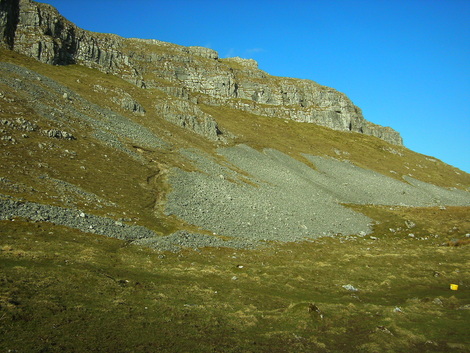
The walk in from Settle provides a (reasonably) gentle prelude to the actual hill-walk which is itself quite short, allowing you to settle (excuse the pun) into your trip and really enjoy the hill. This an excellent ‘mini’-hill-walk, ideal for a gentler walk or an introduction to hill-walking. From the mast on High Greet follow the faint path through the grasses and rushes, not far from the wall on your left, running uphill. The going can be quite boggy in places but this short walk to the summit provides everything a hill-walk should, a broad ridge, a slight and subtle path, wildlife, views, a summit ahead and above all peace and quiet. (Although I find avoiding the inevitable shooting-season from September to the end of January helps as the sound of distant gun-fire from the south does nothing for the peace). Much of the time you’ll have the hill to yourself. Having crossed the first wall by way of a stile you’ll soon come to a short sharp rocky rise. Above this look for a crossing point in the wall on your left, there are steps, and cross over onto the foot of Rye Loaf summit. Pick your way up from here to the cairn on the summit where views far and wide are to be had in good weather. This cairn is thought to be a prehistoric burial cairn, perhaps for a local chieftain or someone of significance in the ancient community to warrant such a final resting place.
You’re now four miles into the walk and although it’s worth pausing for a moment at the summit there is a better place to sit for a coffee and a sandwich. Head north-north-east from the summit alongside a ruined wall and you’ll come to a short sharp grassy, rushy drop to a beck below. This slope is a favourite of mine for a sit and a brew. It has no far-reaching views but offers a quiet, relaxing nook all to yourself and the short-range view onto the limestone hill-side ahead is pleasant indeed. Rye-Loaf Hill and it’s sister summit Kirkby Fell lie on millstone grit, giving the poor drainage and rushy appearance, whereas the hillside across the way is all limestone, cream and green and dry. You’re sat right on the edge of a geological fault-line, one of the Craven Faults.
Finally rising from this cosy resting spot head down to the beck below. Follow this west a short way until you see the corner of a wall above you across the beck. Head for this and you’ll spy a gate-way in the adjoining wall. Go through and you’re on Stockdale Lane. From here the route’s simple, just follow the track down this gorgeous little dale, past Stockdale Farm and onto the farm-road. The limestone scenery is subtle but beautiful and Wheatears keep you company in summer. On reaching the tarmac follow the lane down to it’s first proper bend where a footpath leads off on the right. You can either stick with the lane back down to the stock pens mentioned earlier or you can take the footpath. I recommend the latter.
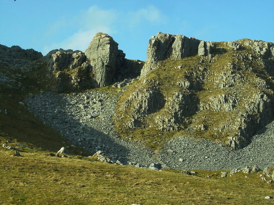
With the wall to your left follow this footpath through the first field and into the second. If your looking hard enough you might make out some very faint earthworks here, the remnants of an early settlement, perhaps post-Roman and probably responsible for the place-name here, Hallsteads, itself a later Norse name meaning ‘steading of the rocks’, most appropriate.Into the third and then fourth field and your standing at the edge of some of the finest limestone rock scenery in Britain. On your left is Attermire itself, the old marshland below Hallsteads, still rushy and damp. On your right is Attermire Scar, a great cliff of limestone with the impressive looking cleft of Horseshoe Cave, accessible by sheep track and some care. Just above Horseshoe and pretty-much hidden away is Attermire Cave, again accessible by sheep track and narrow ledge and suitable only for the experience walker with a head for heights. Take care if you venture up. A third cave is more easily seen a short way along the cliff to the left and is a little more accessible, although once more by sheep-track and grassy ledge and still somewhat airy and risky on a windy day.
Finally rising from this cosy resting spot head down to the beck below. Follow this west a short way until you see the corner of a wall above you across the beck. Head for this and you’ll spy a gate-way in the adjoining wall. Go through and you’re on Stockdale Lane. From here the route’s simple, just follow the track down this gorgeous little dale, past Stockdale Farm and onto the farm-road. The limestone scenery is subtle but beautiful and Wheatears keep you company in summer. On reaching the tarmac follow the lane down to it’s first proper bend where a footpath leads off on the right. You can either stick with the lane back down to the stock pens mentioned earlier or you can take the footpath. I recommend the latter.
With the wall to your left follow this footpath through the first field and into the second. If your looking hard enough you might make out some very faint earthworks here, the remnants of an early settlement, perhaps post-Roman and probably responsible for the place-name here, Hallsteads, itself a later Norse name meaning ‘steading of the rocks’, most appropriate.Into the third and then fourth field and your standing at the edge of some of the finest limestone rock scenery in Britain. On your left is Attermire itself, the old marshland below Hallsteads, still rushy and damp. On your right is Attermire Scar, a great cliff of limestone with the impressive looking cleft of Horseshoe Cave, accessible by sheep track and some care. Just above Horseshoe and pretty-much hidden away is Attermire Cave, again accessible by sheep track and narrow ledge and suitable only for the experience walker with a head for heights. Take care if you venture up. A third cave is more easily seen a short way along the cliff to the left and is a little more accessible, although once more by sheep-track and grassy ledge and still somewhat airy and risky on a windy day.
Beyond Attermire Scar you cannot fail to be stopped in your tracks by Warrendale Knotts, an amazing jumble of crags and scree. As you reach the wall at the end of Attermire Scar a footpath heads north uphill between the Scar and the Knotts. A little over half-a-mile along this footpath lies the impressive gaping mouth of Victoria Cave, once home to a variety of prehistoric wildlife, now excavated and well-worth a visit either as an extension to this walk or on another walk on another day.Back at the wall at the end of the Scar cross over and take some time to explore Warrendale Knotts, well-worth the effort and a great spot for a final cuppa. Below the first of the Knotts you’ll find a crossing in the wall, take this and follow the grassy path beside the small rise of Sugarloaf Hill before descending to the road-side at the foot of Stockdale Lane. Turn right onto the lane and right again, taking the road back to Settle and a well-earned drink in the pub or coffee shop in town.
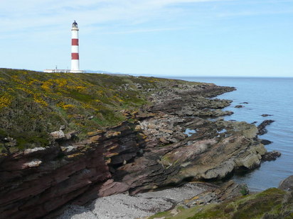
TARBAT NESS EPIC
TARBAT NESS EPIC – Portmahomack – Tarbat Ness, Balintore, Rockfield, Portmahomack.
21miles. Coastal walk with option for a shorter 8 mile walk.
(ALL PHOTOS IN THIS NOTE ARE FROM THE INTERNET, LABELLED "FOR NON-COMMERCIAL REUSE" AND ARE THE PROPERTY OF THE COPYRIGHT HOLDERS).
Easter Ross, the low-lying lands between the Cromarty and Dornoch Firths, are home to a variety of lovely habitats, forests, hills, farmland and heaths and is home too to a large variety of wildlife but it is fair to say that the area loses out to its Highland neighbours when it comes to stunning scenery. No mountains, no great deep glens. There is, however, one exception, the coast. The coast of the Hills of Nigg is high, rocky, cliff-girt, ending in the North Sutor, guarding the entrance to the Cromarty Firth. But north of these great cliffs, lower lying ones offer another, even more beautiful coast. The low-lying cliffs and coastal terraces of Tarbat Ness give a peaceful, often solitary epic of a walk.
This 21 mile epic walk starts and finishes in Portmahomack. 13 miles of the walk involves a there-and-back experience and there is an 8 mile short option but despite the length and despite retracing your steps this walk is well-worth doing in it’s entirety, it’s an unforgettable experience.
Make your way to the characterful fishing village of Portmahomack, home to a major Pictish centre, itself well worth visiting. Park where you can in the village and make your way towards the harbour.
Opposite the middle of the harbour a lane turns off the village street and winds its way past houses and the football pitch towards the sewage works. At the end of the football pitch cross the field between the sewage works and the shore. This inauspicious start to the walk soon brings you out between the gorse bushes and the fields and takes you through beautifully quiet farmland above the sea. The views across the open mouth of the Dornoch Firth, Baefjord to the old Norse, to Sutherland are exceptional. Making use of field gates and Scotland’s excellent access laws you can wander without concern northwards.
A little under 2miles into the walk you will cross a field called Blar a’chath, a name meaning 'battle field', and it may well be here that a pitched battle was fought in 1035between the Orcadian Jarl Thorfinn and a Scots king named Karl Hundason,possibly King Duncan by another name. The Orcadian won the day and King Karl fled. The battle was said to be something of an epic and it’s hard now, walking through quiet fields, with just the seabirds and larks calling, that once this field was bloody and strewn with the dead and dying.
On past the gorse and the archaeological remains at Castlehaven your path takes on ever on through the fields and above the shore to the headland called Tarbat Ness and its tall lighthouse.
A gate in the lighthouse enclosure walls gives access to the maritime heath about the light and a short walk takes you to the very tip of the headland. Head back past the lighthouse and onto the lane. Where the first right-angle bend in the road is met take the track down the cleft onto the beach. Much of the coast from here south to the seaboard villages of Cadboll, Balintore and Shandwick boasts a raised bench of grass, a natural terrace left behind when the thawing land rose from beneath the pressure of ice at the end of the Ice-Age. This terrace, nestling below the low cliffs provides a peaceful solitude that is so often hard to find and gives the walker a world of their own to explore for the rest of the day.
Follow along the shore, keeping on eye out for the seabirds, Gulls, Fulmars, Cormorants, Shags, Auks. Look too for Otters. I saw my first otters along this coast,wandering across the beach and into the sea, at midday! Dolphins and Porpoises frequent the seas and Harbour and Grey seals can be seen.
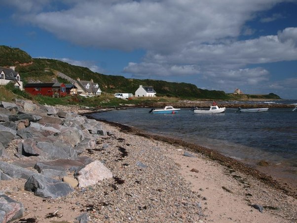
Some two and half miles along this terraced shore stands, on the cliff above, the restored Ballone Castle and just beyond the surprising village of Rockfield. Rockfield is a hidden gem nestling below the cliffs on that shore-bound terrace but the houses must be terribly exposed to the freezing north-easterly winds when they blow direct from Arctic Norway.
Some two and half miles along this terraced shore stands, on the cliff above, the restored Ballone Castle and just beyond the surprising village of Rockfield. Rockfield is a hidden gem nestling below the cliffs on that shore-bound terrace but the houses must be terribly exposed to the freezing north-easterly winds when they blow direct from Arctic Norway.
Here, at Rockfield, you must make a choice, do you abandon this quiet peaceful solitude and take the road up the cliff and back to Portmahomack or do you carry on, to return later, along this magical shore.
To return to Portmahomack simply follow the road back across the farmlands. But better to carry on. 21 miles is a long walk but the going is level and the distractions considerable.
Two miles on from Rockfield you pass Tarrel bothy, a restored fisherman’s bothy, and just beyond Tarrel cave. Beyond here a clearer track is picked up and the coast curves subtly inward, giving amazing views south to the Hills of Nigg and the five-hundred foot high cliffs at Caanrigh.
Three more miles of solitude before you meet civilization again at Hilton of Cadboll, the first of three settlements that, together with Balintore and Shandwick, make up the Seaboard Villages. Spare time to take in the human world again and sit at the harbour in Balintore before, once again, walking off along the beach, this time northwards and back to Portmahomack.
This is no let-down, no anti-climax for the views on the return leg are of course new,looking north-east not south-west and heading away from, for a time, human habitation and back into a world dominated by the sea, the shore and the sky. Savour every moment of the six miles of solitude before reaching again Rockfield.
Now take the only road, up the cliff-side and across the fields by Fairfield and Highfield back to Portmahomack and another shore and the end of a long but surprisingly memorable day.
Now take the only road, up the cliff-side and across the fields by Fairfield and Highfield back to Portmahomack and another shore and the end of a long but surprisingly memorable day.
